I passed through Oswego earlier in the week – Oswego, Montana that is. There is nothing to report. I like our Oswego much better.
I passed through Oswego earlier in the week – Oswego, Montana that is. There is nothing to report. I like our Oswego much better.

US Highway 2 is known here as the Hi-Line. As I cross Montana I have seen changes in the land use. In the west wheat dominated the landscape. Today I saw cattle and grassland. After crossing the Milk River the first time I started to see trees.
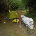
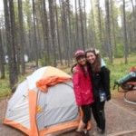
Below is a picture camping in a city park in Malta, MT Sunday night. Just about the time we turned in – (9:30pm) the rain started with very strong winds. Being under the shelter instead of on the grass turned out to be the better choice.
 <
<
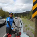
I am staying at Montana State in Havre this evening. I rode here with Peter McKay from Juneau, Alaska. It was a short day, about 34 miles from Hingham where we camped last night. The two previous days were 70 plus miles. Tomorrow’s goal is Malta, just over 80 mile east. The wind was out of the west on Thursday, making the ride from East Glacier to Shelby, MT enjoyable. This is the third day with no rain! Yesterday strong winds were slightly from behind, but crossing enough to move me when semi-trucks went by. Today the wind was somewhat southwest, helping a little and not causing in problem with traffic.
There have been lots of small hills. None are too steep or long. We stopped at Havre Bicycle Shop this afternoon -free check on tire pressure and a good increase. I am expecting better rolling tomorrow.
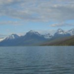
As you will see in the gallery below, I left the moutains behind. I could see them for a while after Browning. Today I saw the Bear Paw Mountains. This part of the country has millions of acres of wheat. I did see a little winter wheat this morning, but most has been planted this spring.
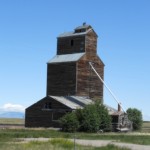
There is a lot of distance between services. The little stage coach towns are mostly gone. Some towns are just a grain elevator and maybe a house or two.
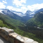
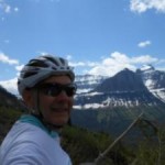


I am over the Rocky Mountains! I climbed enough to cross the contenental divide yesterday riding up Going to the
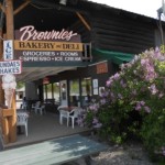
Sun Road. I met Dan from Pennsylvania before Marias Pass (5215 feet). We chatted for a while and met again at Brownies Hostel in East Glacier. I almost camped at the pass, but it started raining and the wind was really howling.
At the beginning of the climb the grade was almost 15 percent. I was concerned about being able to make it over. After that first “hill,” the grades was more moderate and I made it over the top. The rain and wind pushed me downhill to East Glacier.
It has rained part of everyday for more than a week. Tomorrow is supposed to be dry at least after I get out of East Glacier.
I am just north of the “A” at the edge of Dickey Lake. About 39 miles to Whitefish, MT. It is 42 degrees there this morning. The expected high is 59. I am looking forward to the warm part of the day.
Time to pack up and get on the road.
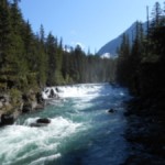
I am sitting in my one man tent in the rain at North Dickey Lake Campground (National Forest Service). Today is a free day! The host is providing wifi, so I am updating the blog. It rained soon after I left Rocky Gorge Campground this morning. It eventually stopped, but picked up when I reached Eureka. I am south of Fortine, MT this evening. I hope to be in Columbia Falls for Sunday evening.
It has been very slow the last two day. I was off course seriously yesterday – about 20 miles round trip on Fisher River Rd. – More than 68 miles riden – about 45 on course. The roads have been up and down. This afternoon the grade was very steep on one road with a slope over 10 percent, kicking up to 19 percent at the end. I walked for 8 or 10 minutes.
I don’t know what the trailer with my load weights (more after grocery shopping this afternoon), but I think it is too heavy.
I rode about 48 miles today. It will be a little more than that to Columbia Falls tomorrow.
I did take a few pictures, but not many with all of the rain. It was 47 degrees this afternoon. I am warm in the tent now. Last night was cooler. I am nearing the Rocky Mountains and Glacier National Park.
 Week 1 plus 1 day:
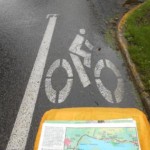
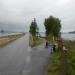
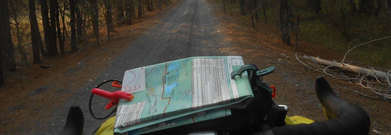
Map 1 has 15 segments. We stopped in Newport, Washington on the Idaho border – there is one more segment in Map 1 that takes me to Sandpoint, ID. I have cycled 431 miles of the course. With off course miles, city rides and locating my wife in towns my total is 503 miles.
As I previously posted, it has been frustrating not having cell phone access with t-mobile. Others have been okay with Verizon and AT&T. I have not had 4G service since leaving the Seattle area. I may have to stop at libraries to upload some photos. With Internet access at the motel tonight I can catch up. Enjoy the photo gallery of the first week below.
Three days of climbing passes has been a hard workout. I took advantage of the low gearing on my bike. The front small chain ring has 26 teeth that can be used with a 34 tooth cog on the rear. I was riding about 5 mph on the long climbs. Sometimes the speed was lower.
Today started with a downhill. I had rolling hills and a head wind much of the day. I averaged 12.5 mph which is the best I have managed since leaving the coast area.
On the plus side, the descents from Washington Pass and Sherman Pass are the longest downhills I have ever enjoyed. Each of theses was about 7 miles. Speeds were in the upper 20s to just over 40 mph. The heavy touring tires and the handlebar bag probably keep the speed down.
Powered by WordPress & Theme by Anders Norén